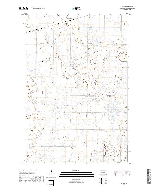
2024 Map of Hoving
USGS Topo · Published 2024About this map
Hoving sits amidst the characteristic prairie pothole landscape of Sargent County, where the terrain is defined by a dense network of small wetlands and seasonal basins. This modern survey illustrates how conservation and agriculture coexist in the eastern North Dakota plains, with the Sargent County Waterfowl Production Area preserved in fragmented blocks across the southern half of the quadrangle. The township-and-range grid is strictly maintained by gravel roads like 81st St SE and north-south corridors such as 135th Ave SE. For local historians and genealogists, the map preserves the precise locations of rural landmarks like Zion Cem and Dunbar Cem, which serve as quiet markers of the area's early settlement history. These sites, along with the route toward Buffalo Lake Rd, reflect the enduring agrarian character of this corner of the state.
Find a feature on this map
24 named features on this map. Tap any name to fly to it.
Don’t see what you’re looking for? This feature index may not catch every label — zoom into the map to look around manually.
Map Details
Editions of this 2024 Hoving Map
This is the sole edition of this map. No revisions or reprints were ever made.
Other maps of this area

1907 · Wyndmere
USGS Topo · 1:125,000

1953 · Fargo
USGS Topo · 1:250,000

1956 · Fargo
USGS Topo · 1:250,000

1958 · Rutland
USGS Topo · 1:24,000
1958 · Forman
USGS Topo · 1:24,000

1958 · Cayuga NW
USGS Topo · 1:24,000
1958 · Cayuga
USGS Topo · 1:24,000

1960 · Lisbon SE
USGS Topo · 1:24,000

1960 · Milnor
USGS Topo · 1:24,000
1962 · Hoving
USGS Topo · 1:24,000