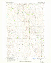
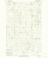
1962 Map of Hoving
USGS Topo · Published 1964About this map
Northern Pacific railroad tracks cut a sharp diagonal across the northern edge of this Sargent County landscape, serving the small settlement of Hoving. The terrain is defined by a dense mosaic of prairie potholes and depressions, typical of the glaciated plains of North Dakota. This 1962 field-checked survey reveals a quiet agricultural interior organized by township boundaries like Willey and Dunbar.
Find a feature on this map
9 named features on this map. Tap any name to fly to it.
Don’t see what you’re looking for? This feature index may not catch every label — zoom into the map to look around manually.
Map Details
Editions of this 1962 Hoving Map
This is the sole edition of this map. No revisions or reprints were ever made.
Other maps of this area
1907 · Wyndmere
USGS Topo · 1:125,000

1953 · Fargo
USGS Topo · 1:250,000

1956 · Fargo
USGS Topo · 1:250,000
1958 · Rutland
USGS Topo · 1:24,000
1958 · Forman
USGS Topo · 1:24,000
1958 · Cayuga NW
USGS Topo · 1:24,000
1958 · Cayuga
USGS Topo · 1:24,000
1960 · Lisbon SE
USGS Topo · 1:24,000
1960 · Milnor
USGS Topo · 1:24,000
1962 · Lisbon SW
USGS Topo · 1:24,000