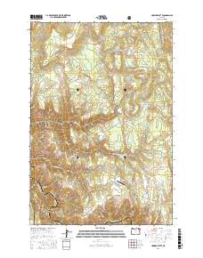
2017 Map of Howard Butte
USGS Topo · Published 2017About this map
Wallowa National Forest land dominates this high-country landscape on the border of Union and Wallowa Counties. The terrain is defined by a sequence of upland meadows and named ridges that descend toward the Wallowa River in the south. These meadows, including Howard Meadow, Deerings Meadow, and Wise Meadow, served as critical landmarks for grazing and early forest management. Notable topographic features such as Howard Butte, Sopher Ridge, and Ednas Point provide vertical relief above the deep cuts of Skylight Canyon and Rock Creek. A rare sign of modern infrastructure in this remote area is the Lazy F Ranch Airport, located on the plateau near Wise Creek. Transport through the timber and ranch lands is facilitated by a network of forest roads like Brown Rd and Smith Mountain Rd.
Find a feature on this map
29 named features on this map. Tap any name to fly to it.
Don’t see what you’re looking for? This feature index may not catch every label — zoom into the map to look around manually.
Map Details
Editions of this 2017 Howard Butte Map
This is the sole edition of this map. No revisions or reprints were ever made.
Other maps of this area

1955 · Grangeville
USGS Topo · 1:250,000

1959 · Grangeville
USGS Topo · 1:250,000

1964 · Howard Butte
USGS Topo · 1:24,000

1964 · Akers Butte
USGS Topo · 1:24,000

1964 · Cricket Flat
USGS Topo · 1:24,000

1964 · Wallowa
USGS Topo · 1:24,000

1964 · Minam
USGS Topo · 1:24,000

1964 · Rondowa
USGS Topo · 1:24,000

1967 · Fry Meadow
USGS Topo · 1:24,000

1967 · Promise
USGS Topo · 1:24,000