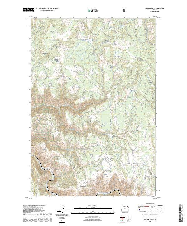
2024 Map of Howard Butte
USGS Topo · Published 2024About this map
Wallowa National Forest dominates this northern Oregon landscape, where the terrain transitions from high ridges like Sopher Ridge to the deep cut of Skylight Canyon. The map reveals a complex network of seasonal drainages including Howard Creek, Grossman Creek, and Fisher Creek, which ultimately feed toward the Wallowa Wild and Scenic River in the south. The distribution of family-named clearings such as Downards Meadow, Deerings Meadow, Eustis Meadow, and James Meadow suggests a legacy of high-altitude ranching or grazing common in the Blue Mountains. Near the eastern edge, the Lazy F Ranch Airport sits as a lonely outpost of modern infrastructure between the peaks of Howard Butte and Smith Mtn.
Find a feature on this map
27 named features on this map. Tap any name to fly to it.
Don’t see what you’re looking for? This feature index may not catch every label — zoom into the map to look around manually.
Map Details
Editions of this 2024 Howard Butte Map
This is the sole edition of this map. No revisions or reprints were ever made.
Other maps of this area

1955 · Grangeville
USGS Topo · 1:250,000

1959 · Grangeville
USGS Topo · 1:250,000

1964 · Howard Butte
USGS Topo · 1:24,000

1964 · Akers Butte
USGS Topo · 1:24,000

1964 · Cricket Flat
USGS Topo · 1:24,000

1964 · Wallowa
USGS Topo · 1:24,000

1964 · Minam
USGS Topo · 1:24,000

1964 · Rondowa
USGS Topo · 1:24,000

1967 · Fry Meadow
USGS Topo · 1:24,000

1967 · Promise
USGS Topo · 1:24,000