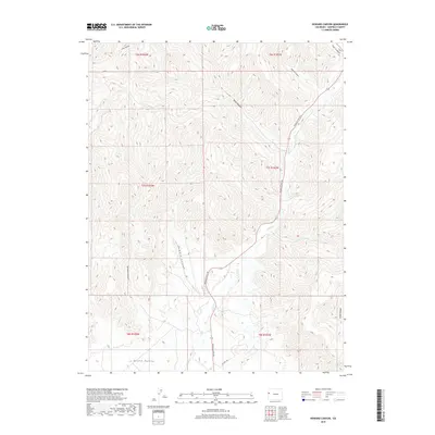
2019 Map of Howard Canyon
USGS Topo · Published 2019About this map
Grand Valley in Garfield County is defined by a complex network of drainage systems and high-altitude canyons as they appeared in 2019. The landscape is dominated by the north-south transit corridor of Douglas Pass Rd, which follows the contours of the terrain alongside E Salt Cr. This remote area of western Colorado shows a distinct pattern of land management through various township and range divisions, including t7s r103w and t7s r102w. Numerous named canyons like Howard Canyon, Demaree Canyon, and Spink Canyon illustrate the erosional history of the plateau, while smaller waterways such as Munger Cr feed into the larger valley system. This topographic record is essential for understanding the connectivity of mountain passes and the hydraulic layout of the region before further modern developments.
Find a feature on this map
18 named features on this map. Tap any name to fly to it.
Don’t see what you’re looking for? This feature index may not catch every label — zoom into the map to look around manually.
Map Details
Editions of this 2019 Howard Canyon Map
This is the sole edition of this map. No revisions or reprints were ever made.
Other maps of this area

1956 · Grand Junction
USGS Topo · 1:250,000

1959 · Grand Junction
USGS Topo · 1:250,000

1960 · Grand Junction
USGS Topo · 1:250,000

1962 · Grand Junction
USGS Topo · 1:250,000

1964 · Grand Junction
USGS Topo · 1:250,000

1964 · Douglas Pass
USGS Topo · 1:24,000

1964 · Baxter Pass
USGS Topo · 1:24,000

1964 · Calf Canyon
USGS Topo · 1:24,000

1965 · Grand Junction
USGS Topo · 1:250,000

1968 · Badger Wash
USGS Topo · 1:24,000