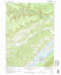
1967 Map of Howard
USGS Topo · Published 1973About this map
Sayers Lake dominates the southeastern valley floor, created by the damming of Marsh Creek Valley near the town of Howard. This 1967 survey, with 1973 revisions, documents the landscape as the new reservoir altered local geography, showing areas subject to controlled inundation in blue. North of the lake, the terrain rises sharply into the Sproul State Forest and State Game Lands No 92, where deep drainages like Beech Creek and Lick Run carve through the high ground. Small rail-side settlements like Orviston and Monument sit along the northern watercourses, while Romola and its associated cemeteries occupy the central valley. The Penn Central railroad follows the shoreline of the lake and the base of Bald Eagle Mtn, illustrating the critical corridor through which industry and transport moved between the ridges of central Pennsylvania.
Find a feature on this map
34 named features on this map. Tap any name to fly to it.
Don’t see what you’re looking for? This feature index may not catch every label — zoom into the map to look around manually.
Map Details
Editions of this 1967 Howard Map
Other maps of this area

1908 · Bellefonte
USGS Topo · 1:62,500

1909 · Bellefonte
USGS Topo · 1:62,500

1921 · Howard
USGS Topo · 1:48,000

1923 · Howard
USGS Topo · 1:62,500

1924 · Centre Hall
USGS Topo · 1:62,500

1928 · Snow Shoe
USGS Topo · 1:48,000

1929 · Centre Hall
USGS Topo · 1:62,500

1931 · Show Shoe
USGS Topo · 1:62,500

1943 · Lewistown
USGS Topo · 1:125,000

1950 · Harrisburg
USGS Topo · 1:250,000