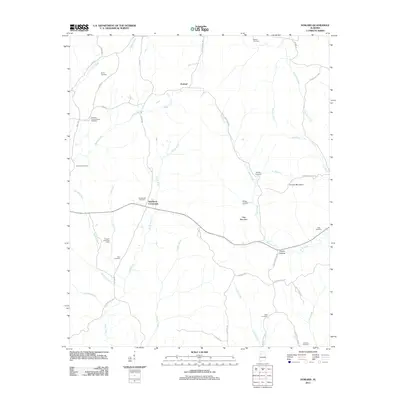
2011 Map of Howard
USGS Topo · Published 2011About this map
North River and its numerous tributaries, including Boxes Creek, Wolf Creek, and George Creek, carve through the upland landscape of Walker County near the community of Howard. The settlement pattern is defined by rural crossroads and family-named landmarks, most notably Studdards Crossroads and several early burial grounds like Harris Cemetery and Willis Cemetery. High points such as Cooner Mountain and Tittle Mountain overlook a topography that transitions from agricultural land to industrial use, evidenced by the Tanyard Creek Gas Field in the southwest. This 2011 survey records the intersection of genealogy and industry, where old sites like the Johnson School House Cemetery persist alongside modern resource extraction and the winding paths of Pea Ridge Rd and Feltman Rd.
Find a feature on this map
55 named features on this map. Tap any name to fly to it.
Don’t see what you’re looking for? This feature index may not catch every label — zoom into the map to look around manually.
Map Details
Editions of this 2011 Howard Map
This is the sole edition of this map. No revisions or reprints were ever made.
Other maps of this area

1893 · Jasper
USGS Topo · 1:125,000

1949 · Townley
USGS Topo · 1:24,000

1949 · Oakman
USGS Topo · 1:24,000

1949 · Nauvoo
USGS Topo · 1:24,000

1950 · Nauvoo
USGS Topo · 1:24,000

1951 · Oakman
USGS Topo · 1:24,000

1951 · Townley
USGS Topo · 1:24,000

1953 · Birmingham
USGS Topo · 1:250,000

1956 · Birmingham
USGS Topo · 1:250,000

1957 · Birmingham
USGS Topo · 1:250,000