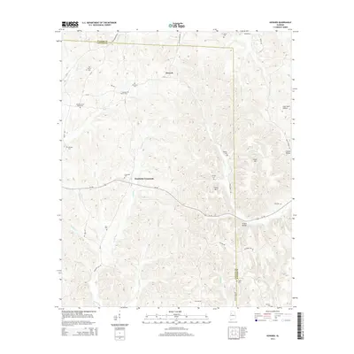
2014 Map of Howard
USGS Topo · Published 2014About this map
Studdards Crossroads and the settlement of Howard anchor this portion of the Alabama landscape where the boundaries of Walker and Fayette counties meet. The terrain is defined by a dense network of watercourses including the North River, Wolf Creek, and George Creek, which carve through the hilly region marked by summits like Cooner Mountain and Tittle Mountain. For genealogists, the map is particularly detailed in its recording of family and community burial grounds, such as Elm Grove Cemetery, Johnston Cemetery, and Whitley Cemetery. The preservation of labels like Johnson School House Cemetery and the Pleasant Grove School suggests the locations of former civic centers. This modern survey reflects a landscape where rural traditions persist, with old homestead names like Moore Cemetery and Harris Cemetery still marking the topography alongside features such as Frozen Hollow and Gum Suck Hollow.
Find a feature on this map
58 named features on this map. Tap any name to fly to it.
Don’t see what you’re looking for? This feature index may not catch every label — zoom into the map to look around manually.
Map Details
Editions of this 2014 Howard Map
This is the sole edition of this map. No revisions or reprints were ever made.
Other maps of this area

1893 · Jasper
USGS Topo · 1:125,000

1949 · Townley
USGS Topo · 1:24,000

1949 · Oakman
USGS Topo · 1:24,000

1949 · Nauvoo
USGS Topo · 1:24,000

1950 · Nauvoo
USGS Topo · 1:24,000

1951 · Oakman
USGS Topo · 1:24,000

1951 · Townley
USGS Topo · 1:24,000

1953 · Birmingham
USGS Topo · 1:250,000

1956 · Birmingham
USGS Topo · 1:250,000

1957 · Birmingham
USGS Topo · 1:250,000