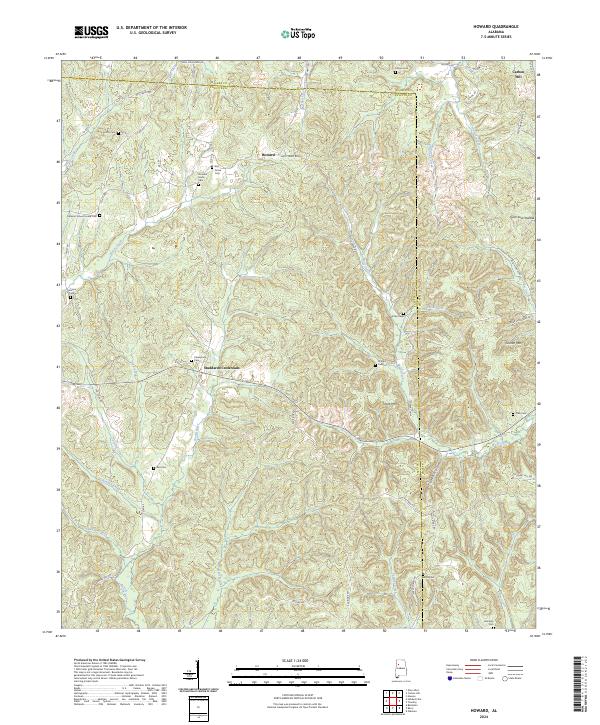
2024 Map of Howard
USGS Topo · Published 2024About this map
Studdards Crossroads and the settlement of Howard anchor this modern topographical study of the Fayette and Walker county line. The landscape is defined by the winding course of the North River and its numerous tributaries, including Tanyard Creek and Lick Creek. These waterways carve through the terrain, creating named landmarks such as Gum Suck Hollow and Tittle Mtn. The area is notably dense with family and community burial grounds, serving as a vital record for genealogists.
Find a feature on this map
72 named features on this map. Tap any name to fly to it.
Don’t see what you’re looking for? This feature index may not catch every label — zoom into the map to look around manually.
Map Details
Editions of this 2024 Howard Map
This is the sole edition of this map. No revisions or reprints were ever made.
Other maps of this area

1893 · Jasper
USGS Topo · 1:125,000

1949 · Townley
USGS Topo · 1:24,000

1949 · Oakman
USGS Topo · 1:24,000

1949 · Nauvoo
USGS Topo · 1:24,000

1950 · Nauvoo
USGS Topo · 1:24,000

1951 · Oakman
USGS Topo · 1:24,000

1951 · Townley
USGS Topo · 1:24,000

1953 · Birmingham
USGS Topo · 1:250,000

1956 · Birmingham
USGS Topo · 1:250,000

1957 · Birmingham
USGS Topo · 1:250,000