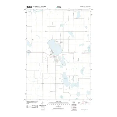
2010 Map of Howard Lake
USGS Topo · Published 2010About this map
Howard Lake serves as the central hub of this Wright County landscape, where the town’s grid meets the irregular shorelines of numerous glacial water bodies. The community is anchored by essential civic landmarks including the Howard Lake Post Office and the Wright County Fairgrounds, while the surrounding countryside is dotted with local heritage sites such as Reinmuth Cemetery and Saint James Cemetery. A complex network of secondary roads, like Keats Ave SW and Kilbury Ave SW, bisects the area, providing access to a series of recreational and natural features.
Find a feature on this map
60 named features on this map. Tap any name to fly to it.
Don’t see what you’re looking for? This feature index may not catch every label — zoom into the map to look around manually.
Map Details
Editions of this 2010 Howard Lake Map
This is the sole edition of this map. No revisions or reprints were ever made.
Other maps of this area

1953 · Saint Paul
USGS Topo · 1:250,000

1953 · New Ulm
USGS Topo · 1:250,000

1953 · Saint Cloud
USGS Topo · 1:250,000

1953 · Stillwater
USGS Topo · 1:250,000

1955 · Stillwater
USGS Topo · 1:250,000

1957 · Saint Cloud
USGS Topo · 1:250,000

1957 · New Ulm
USGS Topo · 1:250,000

1957 · Waconia
USGS Topo · 1:62,500

1958 · New Ulm
USGS Topo · 1:250,000

1958 · Stillwater
USGS Topo · 1:250,000