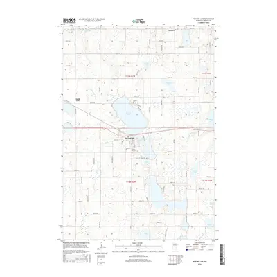
2016 Map of Howard Lake
USGS Topo · Published 2016About this map
Howard Lake serves as the central hub of this Wright County landscape, where the town of the same name sits along the southern shore of its namesake waters. The terrain is defined by a dense network of glacial lakes and wetlands, including Milky Lake, Mallard Pass Lake, and Taylor Lake, all connected by a grid of rural roads like 60th St SW. The area's long-standing community foundations are evident in the placement of several local burial grounds, such as Reinmuth Cem, Howard Lake Cem, and Saint James Cem. To the northwest, the North Fork Crow River winds through the corner of the map, while the settlement at Smith Lake and the high ground at Highland mark the limits of the local township. The dense concentration of water bodies like Long Lake and Lake Mary in the south suggests a landscape heavily shaped by its hydrology, impacting both agricultural layout and local transportation patterns.
Find a feature on this map
83 named features on this map. Tap any name to fly to it.
Don’t see what you’re looking for? This feature index may not catch every label — zoom into the map to look around manually.
Map Details
Editions of this 2016 Howard Lake Map
This is the sole edition of this map. No revisions or reprints were ever made.
Other maps of this area

1953 · Saint Paul
USGS Topo · 1:250,000

1953 · New Ulm
USGS Topo · 1:250,000

1953 · Saint Cloud
USGS Topo · 1:250,000

1953 · Stillwater
USGS Topo · 1:250,000

1955 · Stillwater
USGS Topo · 1:250,000

1957 · Saint Cloud
USGS Topo · 1:250,000

1957 · New Ulm
USGS Topo · 1:250,000

1957 · Waconia
USGS Topo · 1:62,500

1958 · New Ulm
USGS Topo · 1:250,000

1958 · Stillwater
USGS Topo · 1:250,000