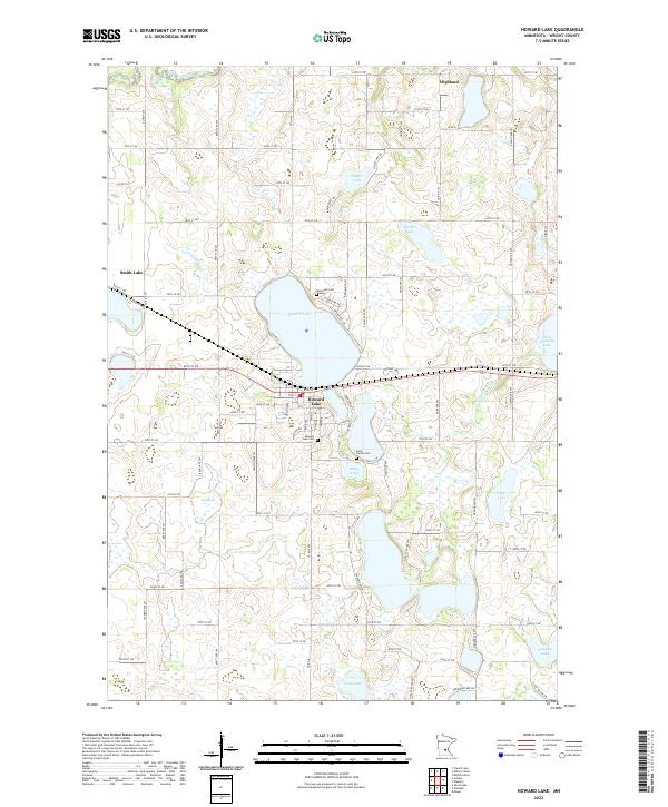
2022 Map of Howard Lake
USGS Topo · Published 2022About this map
Howard Lake serves as the central focal point for this section of Wright County, where the eponymous town is situated along its southern and western shores. The landscape is defined by a dense concentration of glacial basins, including Milky Lake, Taylor Lake, and Doerfler Lake, many of which are connected by smaller tributaries like Twelvemile Cr. To the north, the North Fork Crow River cuts through the terrain, while the small settlement of Smith Lake sits to the west. This 2022 survey documents the local infrastructure of the modern era, showing the grid of rural roads such as 60th St SW and Lathrop Ave SW that separate the various townships. Genealogists will find several burial grounds noted, including Howard Lake Cem, Saint James Cem, and the smaller Reinmuth Cem located north of the main lake.
Find a feature on this map
82 named features on this map. Tap any name to fly to it.
Don’t see what you’re looking for? This feature index may not catch every label — zoom into the map to look around manually.
Map Details
Editions of this 2022 Howard Lake Map
This is the sole edition of this map. No revisions or reprints were ever made.
Other maps of this area

1953 · Saint Paul
USGS Topo · 1:250,000

1953 · New Ulm
USGS Topo · 1:250,000

1953 · Saint Cloud
USGS Topo · 1:250,000

1953 · Stillwater
USGS Topo · 1:250,000

1955 · Stillwater
USGS Topo · 1:250,000

1957 · Saint Cloud
USGS Topo · 1:250,000

1957 · New Ulm
USGS Topo · 1:250,000

1957 · Waconia
USGS Topo · 1:62,500

1958 · New Ulm
USGS Topo · 1:250,000

1958 · Stillwater
USGS Topo · 1:250,000
Featured Places
- Howard Lake, MN
- Marysville Township, MN
- Middleville Township, MN
- Victor Township, MN
- Woodland Township, MN