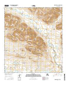
2016 Map of Howard Pass A-1 NE
USGS Topo · Published 2016About this map
The Nigu River flows northward through this remote Arctic landscape, cutting across the northeastern corner of the Noatak National Preserve. This 2016 survey documents a wilderness where water and topography dictate the character of the land, centered around the prominent Koiyaktot Mtn. The hydrology is defined by a network of significant water bodies in the southern portion of the sheet, including the expansive Etivlik Lake, as well as the Inyorurak Lakes and Kikitliorak Lake. The absence of man-made infrastructure or settlements emphasizes the protected nature of the preserve, leaving a landscape defined entirely by its glacial and riverine features. Researchers can examine the high-resolution contour data that illustrates the complex drainage patterns feeding into the river system from the surrounding highlands.
Find a feature on this map
10 named features on this map. Tap any name to fly to it.
Don’t see what you’re looking for? This feature index may not catch every label — zoom into the map to look around manually.
Map Details
Editions of this 2016 Howard Pass A-1 NE Map
This is the sole edition of this map. No revisions or reprints were ever made.
Other maps of this area

1951 · Howard Pass
USGS Topo · 1:250,000

1951 · Killik River
USGS Topo · 1:250,000

1956 · Howard Pass
USGS Topo · 1:250,000

1956 · Killik River
USGS Topo · 1:250,000
1984 · Killik River B-5
USGS Topo · 1:63,360
1984 · Howard Pass B-1
USGS Topo · 1:63,360
1984 · Killik River A-5
USGS Topo · 1:63,360
1984 · Howard Pass A-1
USGS Topo · 1:63,360
2016 · Howard Pass A-1 NW
USGS Topo · 1:25,000
2016 · Howard Pass B-1 SW
USGS Topo · 1:25,000