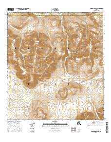
2016 Map of Howard Pass A-2 SE
USGS Topo · Published 2016About this map
Noatak National Preserve defines this landscape in the northern reaches of Alaska, where high-elevation terrain transitions between the North Slope Borough and the Northwest Arctic Borough. The area is characterized by significant topographic relief, most notably at Iikhkluk Mtn, which stands as a prominent landmark amidst the surrounding peaks. The drainage system of Rough Mountain Creek winds through the central and eastern portions of the quadrangle, illustrating the natural watercourses that have carved these valleys over millennia. This 2016 survey documents a remote wilderness largely untouched by industrial infrastructure or permanent settlement, capturing the pristine geography preserved within the national preserve boundaries at the start of the twenty-first century.
Find a feature on this map
10 named features on this map. Tap any name to fly to it.
Don’t see what you’re looking for? This feature index may not catch every label — zoom into the map to look around manually.
Map Details
Editions of this 2016 Howard Pass A-2 SE Map
This is the sole edition of this map. No revisions or reprints were ever made.
Other maps of this area

1951 · Howard Pass
USGS Topo · 1:250,000

1951 · Ambler River
USGS Topo · 1:250,000

1956 · Howard Pass
USGS Topo · 1:250,000

1956 · Ambler River
USGS Topo · 1:250,000

1964 · Ambler River
USGS Topo · 1:250,000
1984 · Howard Pass A-2
USGS Topo · 1:63,360
1984 · Howard Pass A-1
USGS Topo · 1:63,360
1990 · Ambler River D-2
USGS Topo · 1:63,360
2016 · Howard Pass A-1 NW
USGS Topo · 1:25,000
2016 · Howard Pass A-2 NE
USGS Topo · 1:25,000