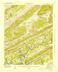
1943 Map of Howard Quarter
USGS Topo · Published 1946About this map
Clinch River and the newly formed Norris Reservoir dominate this 1942 field examination, capturing the landscape just as the Tennessee Valley Authority's infrastructure reshaped the region. The valley floor is marked by family-named landmarks and rural institutions, including Howard Quarter and Howardton. The map reveals a dense network of mountain communities centered around schools and churches, such as Seal Chapel Ch, Ritchie Sch, and Caney Valley Sch.
Find a feature on this map
73 named features on this map. Tap any name to fly to it.
Don’t see what you’re looking for? This feature index may not catch every label — zoom into the map to look around manually.
Map Details
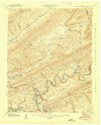
Editions of this 1943 Howard Quarter Map
2 editions found
Other maps of this area

1883 · Morristown
USGS Topo · 1:125,000

1886 · Cumberland Gap
USGS Topo · 1:125,000

1887 · Jonesville
USGS Topo · 1:125,000

1888 · Cumberland Gap
USGS Topo · 1:125,000

1891 · Cumberland Gap
USGS Topo · 1:125,000

1891 · Jonesville
USGS Topo · 1:125,000

1893 · Morristown
USGS Topo · 1:125,000

1895 · Morristown
USGS Topo · 1:125,000

1897 · Maynardville
USGS Topo · 1:125,000

1900 · Maynardville
USGS Topo · 1:125,000