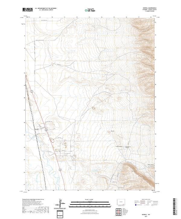
2021 Map of Howell
USGS Topo · Published 2021About this map
The settlement of Howell sits at the intersection of grazing lands and river valley geography in this 2021 study of Albany County. The landscape is defined by the winding course of the Laramie River and an intricate network of irrigation infrastructure including the Pioneer Canal and N Canal. This water management system supports the ranching operations indicated by numerous named roads like Pascoe Ranch Rd and Wind in Wire Ranch Rd. To the east, the terrain rises into the Laramie Mountains foothills, marked by geological features such as Red Hill and deeply cut drainages like Katie Brown Canyon and Roger Canyon. The presence of the Old Smuggler Reservoir and the naming of The Spur highlight the ongoing relationship between the region's historical water rights and its high-plains topography.
Find a feature on this map
39 named features on this map. Tap any name to fly to it.
Don’t see what you’re looking for? This feature index may not catch every label — zoom into the map to look around manually.
Map Details
Editions of this 2021 Howell Map
This is the sole edition of this map. No revisions or reprints were ever made.
Other maps of this area

1895 · Laramie
USGS Topo · 1:125,000

1902 · Laramie
USGS Topo · 1:125,000

1905 · Sherman
USGS Topo · 1:125,000

1905 · Laramie
USGS Topo · 1:125,000

1906 · Laramie
USGS Topo · 1:125,000

1908 · Laramie
USGS Topo · 1:125,000

1948 · Ragged Top Mountain
USGS Topo · 1:62,500

1950 · Ragged Top Mountain
USGS Topo · 1:62,500

1954 · Cheyenne
USGS Topo · 1:250,000

1955 · Bosler
USGS Topo · 1:24,000