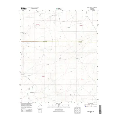
2013 Map of Howell Ranch
USGS Topo · Published 2013About this map
Howell Ranch and Gammill Ranch anchor this landscape along the boundary of De Baca and Chaves Counties in eastern New Mexico. The terrain is defined by dry drainage systems including White Draw, South Fork White Draw, and Sand Draw, which dictate the placement of ranching infrastructure. Scattered throughout the townships of T2S and T3S are numerous named water sources essential to the local cattle economy, such as Grimes Windmill, Ashbacker Windmill, and Nut Windmill. A network of county roads, including San Patricio Rd and Bojax Rd, connects remote stations like West Camp to the Bojax Ranch Airport. This 2013 survey illustrates the continued reliance on legacy water landmarks and isolated ranching outposts in this arid high plains environment.
Find a feature on this map
34 named features on this map. Tap any name to fly to it.
Don’t see what you’re looking for? This feature index may not catch every label — zoom into the map to look around manually.
Map Details
Editions of this 2013 Howell Ranch Map
This is the sole edition of this map. No revisions or reprints were ever made.
Other maps of this area

1954 · Fort Sumner
USGS Topo · 1:250,000

1954 · Clovis
USGS Topo · 1:250,000

1954 · Brownfield
USGS Topo · 1:250,000

1955 · Roswell
USGS Topo · 1:250,000

1958 · Brownfield
USGS Topo · 1:250,000

1958 · Fort Sumner
USGS Topo · 1:250,000

1958 · Clovis
USGS Topo · 1:250,000

1958 · Roswell
USGS Topo · 1:250,000

1962 · Roswell
USGS Topo · 1:250,000

1962 · Brownfield
USGS Topo · 1:250,000