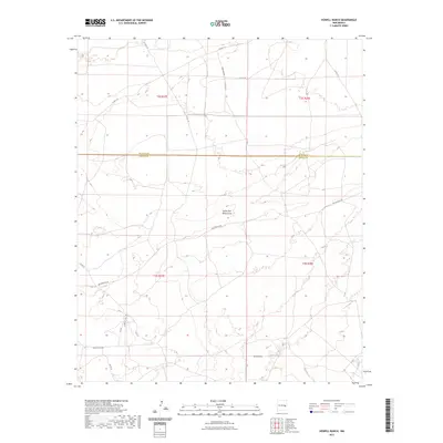
2023 Map of Howell Ranch
USGS Topo · Published 2023About this map
The high plains of the Pecos River valley are defined here by a network of intermittent watercourses and ranching access roads along the border of De Baca and Chaves Counties. Drainage features like South Fork White Draw and Sand Draw carve through the landscape, indicating the natural flow of water in this semi-arid region. The human imprint on the land is primarily evidenced by a grid-like system of county roads and specialized routes such as Bojax Hdqts Rd and Rambling Rd. These paths provide essential connectivity across vast grazing territories, linking remote ranching headquarters to regional thoroughfares like San Patricio Rd. This 2023 survey illustrates the enduring agricultural character of southeast New Mexico, where the infrastructure is built around the needs of large-scale livestock operations and the management of seasonal water resources.
Find a feature on this map
19 named features on this map. Tap any name to fly to it.
Don’t see what you’re looking for? This feature index may not catch every label — zoom into the map to look around manually.
Map Details
Editions of this 2023 Howell Ranch Map
This is the sole edition of this map. No revisions or reprints were ever made.
Other maps of this area

1954 · Fort Sumner
USGS Topo · 1:250,000

1954 · Clovis
USGS Topo · 1:250,000

1954 · Brownfield
USGS Topo · 1:250,000

1955 · Roswell
USGS Topo · 1:250,000

1958 · Brownfield
USGS Topo · 1:250,000

1958 · Fort Sumner
USGS Topo · 1:250,000

1958 · Clovis
USGS Topo · 1:250,000

1958 · Roswell
USGS Topo · 1:250,000

1962 · Roswell
USGS Topo · 1:250,000

1962 · Brownfield
USGS Topo · 1:250,000