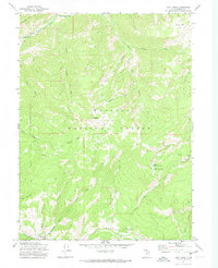
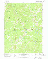
1972 Map of Hoyt Peak
USGS Topo · Published 1974About this map
Hoyt Peak and the high-altitude drainage basins of the Wasatch National Forest dominate this early 1970s topographic study. The landscape is defined by its water systems, from the Weber River in the northwest corner to the glacial features like Upper Yellow Pine Lake and Lower Yellow Pine Lake further south. The settlement of Samak sits at the southwestern edge, serving as a gateway to the network of trails and canyons that traverse the area. Steep elevation changes are marked by numerous named drainages, including Hoyt Canyon and Swifts Canyon. Outdoor recreation and timber history are evident through the labeling of the Yellow Pine Campground and Shingle Mill Flat. This map preserves the mid-century layout of the forest's primitive transportation network, showing an extensive system of pack trails and jeep trails alongside family-named landmarks like Duke Spring.
Find a feature on this map
41 named features on this map. Tap any name to fly to it.
Don’t see what you’re looking for? This feature index may not catch every label — zoom into the map to look around manually.
Map Details
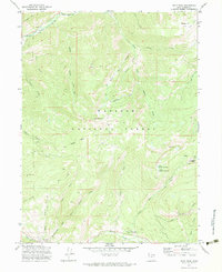
Editions of this 1972 Hoyt Peak Map
3 editions found
Other maps of this area

1885 · Salt Lake
USGS Topo · 1:250,000

1900 · Coalville
USGS Topo · 1:125,000

1903 · Coalville
USGS Topo · 1:125,000

1954 · Salt Lake City
USGS Topo · 1:250,000

1958 · Salt Lake City
USGS Topo · 1:250,000

1960 · Salt Lake City
USGS Topo · 1:250,000

1967 · Francis
USGS Topo · 1:24,000

1967 · Kamas
USGS Topo · 1:24,000
1967 · Crandall Canyon
USGS Topo · 1:24,000
1972 · Erickson Basin
USGS Topo · 1:24,000