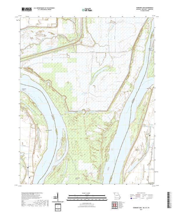
2021 Map of Hubbard Lake
USGS Topo · Published 2021About this map
The Mississippi River defines the landscape of this region, creating a complex geography of cutoffs, sloughs, and peninsulas where the boundaries of New Madrid and Fulton counties meet. This 2021 map documents the intricate riverine environment of the Missouri-Kentucky border, specifically the landlocked portion of Kentucky known as the Kentucky Bend. The area is characterized by a dense network of managed drainage, including Saint Johns Ditch and Mud Ditch, which support the agricultural tracts surrounding the small settlement at Knotts Bridge. Local heritage is anchored by sites such as Lake Chapel Cem, Adams Cem, and Whitson Cem, which are situated along the roads that navigate the low-lying terrain near Hotchkiss Bend and Donaldson Point. The prevalence of deep-water features like Hancock Hole and Ransburgh Hole highlights the dynamic nature of the river's historical channel shifts.
Find a feature on this map
45 named features on this map. Tap any name to fly to it.
Don’t see what you’re looking for? This feature index may not catch every label — zoom into the map to look around manually.
Map Details
Editions of this 2021 Hubbard Lake Map
This is the sole edition of this map. No revisions or reprints were ever made.
Other maps of this area

1925 · Reelfoot Lake
USGS Topo · 1:62,500

1939 · Reelfoot Lake
USGS Topo · 1:62,500

1939 · Portageville
USGS Topo · 1:62,500

1939 · New Madrid
USGS Topo · 1:62,500

1939 · Bayouville
USGS Topo · 1:62,500

1951 · Bondurant
USGS Topo · 1:24,000

1951 · New Madrid SE
USGS Topo · 1:24,000

1951 · Hubbard Lake
USGS Topo · 1:24,000

1954 · New Madrid
USGS Topo · 1:62,500

1955 · Portageville
USGS Topo · 1:62,500