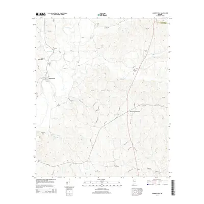
2014 Map of Hubbertville
USGS Topo · Published 2014About this map
Hubbertville and Fowlers Crossroads anchor this rural landscape in the western coal region of Alabama, situated along the Sipsey River. The topography is defined by numerous drainage systems, including Hollingsworth Mill Cr, Beaver Cr, and Boxes Cr, which carve through the terrain near Ford Mtn. This map is particularly dense with genealogical markers, documenting a high concentration of family-named cemeteries and chapels that reflect the area's deep-rooted settlement history. From Tidwell Chapel Cem in the north to Davis Chapel Cem and Cedar Grove Cem in the south, the sheet preserves the location of many local burial grounds. Infrastructure like the McCollum Bridge and roads such as Old Byler RD trace the historic transit patterns across the Walker Co and Fayette Co line, showing how residents moved between small communities like Glen Allen and neighboring farmsteads.
Find a feature on this map
73 named features on this map. Tap any name to fly to it.
Don’t see what you’re looking for? This feature index may not catch every label — zoom into the map to look around manually.
Map Details
Editions of this 2014 Hubbertville Map
This is the sole edition of this map. No revisions or reprints were ever made.
Other maps of this area

1953 · Birmingham
USGS Topo · 1:250,000

1956 · Birmingham
USGS Topo · 1:250,000

1957 · Birmingham
USGS Topo · 1:250,000

1967 · Bankston
USGS Topo · 1:24,000

1967 · Winfield SE
USGS Topo · 1:24,000
1967 · Carbon Hill
USGS Topo · 1:24,000

1967 · Hubbertville
USGS Topo · 1:24,000
1967 · Glen Allen
USGS Topo · 1:24,000
1967 · Berry
USGS Topo · 1:24,000

1967 · Fayette
USGS Topo · 1:24,000