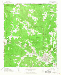
1967 Map of Carbon Hill
USGS Topo · Published 1968About this map
The coal-rich hills of Walker CO are mapped here in the late 1960s, centered on the bustling rail hub of Carbon Hill. This period shows the transition of the local landscape as the St Louis - San Francisco railway remains a dominant artery through Kansas and Eldridge, while a new section of track is marked as under construction south of the town center. The industrial legacy of the region is evident in the numerous gravel pits and strip mines that pock the terrain near the Winston Co line.
Find a feature on this map
39 named features on this map. Tap any name to fly to it.
Don’t see what you’re looking for? This feature index may not catch every label — zoom into the map to look around manually.
Map Details
Editions of this 1967 Carbon Hill Map
3 editions found
Other maps of this area

1893 · Jasper
USGS Topo · 1:125,000

1949 · Townley
USGS Topo · 1:24,000

1949 · Nauvoo
USGS Topo · 1:24,000

1950 · Nauvoo
USGS Topo · 1:24,000

1951 · Townley
USGS Topo · 1:24,000

1953 · Birmingham
USGS Topo · 1:250,000

1956 · Birmingham
USGS Topo · 1:250,000

1956 · Gadsden
USGS Topo · 1:250,000

1957 · Birmingham
USGS Topo · 1:250,000

1958 · Gadsden
USGS Topo · 1:250,000