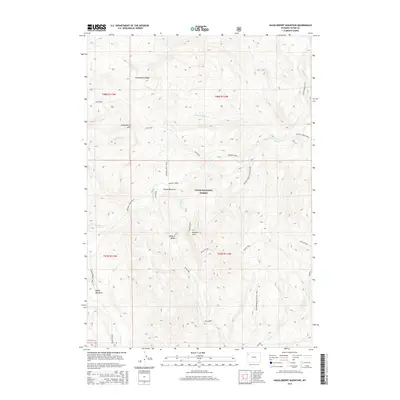
2015 Map of Huckleberry Mountain
USGS Topo · Published 2015About this map
Teton National Forest dominates this 2015 survey, revealing a landscape defined by sharp elevation changes and a dense network of mountain drainages. Central to this topography is the prominence of Wildcat Peak and the adjacent Wildcat Ridge, which separate the headwaters of several key creeks. The map provides a clear look at the high-altitude meadow systems that punctuate the timber, including Brown Meadows and Bailey Meadows, which have historically served as critical landmarks for backcountry navigation. A series of primitive routes, such as the Arizona Creek Trail and the Colter Creek Trail, illustrate how travel in this region remains tied to the natural corridors carved by water. Drainages like Pilgrim Creek and Sheffield Creek flow through deep-cut valleys, reflecting the complex hydrology of the Huckleberry Ridge area.
Find a feature on this map
26 named features on this map. Tap any name to fly to it.
Don’t see what you’re looking for? This feature index may not catch every label — zoom into the map to look around manually.
Map Details
Editions of this 2015 Huckleberry Mountain Map
This is the sole edition of this map. No revisions or reprints were ever made.
Other maps of this area

1885 · Lake
USGS Topo · 1:125,000

1886 · Shoshone
USGS Topo · 1:125,000

1888 · Shoshone
USGS Topo · 1:125,000

1895 · Shoshone
USGS Topo · 1:125,000

1895 · Lake
USGS Topo · 1:125,000

1896 · Lake
USGS Topo · 1:125,000

1899 · Grand Teton
USGS Topo · 1:125,000

1901 · Shoshone
USGS Topo · 1:125,000

1901 · Lake
USGS Topo · 1:125,000

1901 · Grand Teton
USGS Topo · 1:125,000