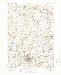
1943 Map of Hudson
USGS Topo · Published 1952About this map
Hudson and the surrounding mill towns of Middlesex and Worcester counties are shown here during a period of mid-century transition. The industrial character of the region is evident in the dense street grid of the main settlement and the infrastructure supporting it, such as the Sewage Disposal facility and the Boston and Maine RR. The Assabet River winds through the landscape, powering local industry at Gleasondale and connecting smaller clusters like East Bolton and Stow.
Find a feature on this map
76 named features on this map. Tap any name to fly to it.
Don’t see what you’re looking for? This feature index may not catch every label — zoom into the map to look around manually.
Map Details
Editions of this 1943 Hudson Map
4 editions found
Other maps of this area

1886 · Lowell
USGS Topo · 1:62,500

1886 · Framingham
USGS Topo · 1:62,500

1887 · Marlboro
USGS Topo · 1:62,500

1889 · Marlboro
USGS Topo · 1:62,500

1889 · Framingham
USGS Topo · 1:62,500

1893 · Lowell
USGS Topo · 1:62,500

1893 · Groton
USGS Topo · 1:62,500

1894 · Framingham
USGS Topo · 1:62,500

1896 · Marlboro
USGS Topo · 1:62,500

1898 · Marlboro
USGS Topo · 1:62,500