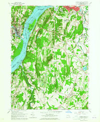
1963 Map of Hudson South
USGS Topo · Published 1965About this map
The Hudson River serves as the central artery of this early 1960s landscape, connecting the industrial and residential centers of Hudson and Catskill. The Rip Van Winkle Bridge spans the water near Rogers Island, anchoring a transport network that includes the New York Central Railroad running along the eastern bank. The terrain rises sharply into the Becraft Hills and Mt Merino, where numerous quarries indicate the area's active mineral extraction industry.
Find a feature on this map
64 named features on this map. Tap any name to fly to it.
Don’t see what you’re looking for? This feature index may not catch every label — zoom into the map to look around manually.
Map Details
Editions of this 1963 Hudson South Map
3 editions found
Other maps of this area

1893 · Coxsackie
USGS Topo · 1:62,500

1894 · Coxsackie
USGS Topo · 1:62,500

1895 · Catskill
USGS Topo · 1:62,500

1902 · Copake
USGS Topo · 1:62,500

1903 · Kinderhook
USGS Topo · 1:62,500

1904 · Copake
USGS Topo · 1:62,500

1929 · Coxsackie
USGS Topo · 1:62,500

1933 · Kinderhook
USGS Topo · 1:62,500

1934 · Catskill
USGS Topo · 1:62,500

1938 · Catskill
USGS Topo · 1:62,500