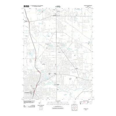
2010 Map of Hudson
USGS Topo · Published 2010About this map
Hudson and Stow anchor this landscape during a period of suburban expansion in northeastern Ohio. The map reveals a dense network of water bodies and historical markers, ranging from the Old Hudson Township Burying Ground and Markillie Cemetery in the north to the Cuyahoga River corridor in the south. Settlement patterns are defined by established nodes like Darrowville, Metz, and Chittendens Corners, which persist alongside modern infrastructure such as the Hudson Industrial Pkwy and the Kent State University Airport.
Find a feature on this map
85 named features on this map. Tap any name to fly to it.
Don’t see what you’re looking for? This feature index may not catch every label — zoom into the map to look around manually.
Map Details
Editions of this 2010 Hudson Map
This is the sole edition of this map. No revisions or reprints were ever made.
Other maps of this area

1903 · Cleveland
USGS Topo · 1:62,500

1903 · Akron
USGS Topo · 1:62,500

1905 · Akron
USGS Topo · 1:62,500

1906 · Kent
USGS Topo · 1:62,500

1906 · Chagrin Falls
USGS Topo · 1:62,500

1908 · Chagrin Falls
USGS Topo · 1:62,500

1950 · Cleveland
USGS Topo · 1:250,000

1953 · Aurora
USGS Topo · 1:24,000

1953 · Twinsburg
USGS Topo · 1:24,000
1953 · Northfield
USGS Topo · 1:24,000