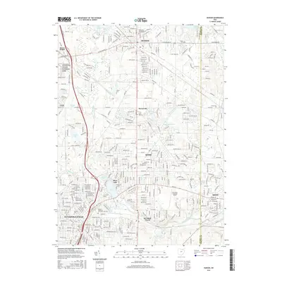
2016 Map of Hudson
USGS Topo · Published 2016About this map
Hudson and the surrounding Summit County suburbs appear in 2016 as a landscape defined by residential expansion interspersed with preserved parklands and historic burial sites. The northwestern quadrant is anchored by the Cuyahoga Valley National Park, while the rest of the area shows the dense grid of modern development connecting Stow, Silver Lake, and Munroe Falls. Local history is preserved in several notable cemeteries, including the Old Hudson Township Burying Ground Cem and the Cackler Cem.
Find a feature on this map
370 named features on this map. Tap any name to fly to it.
Don’t see what you’re looking for? This feature index may not catch every label — zoom into the map to look around manually.
Map Details
Editions of this 2016 Hudson Map
This is the sole edition of this map. No revisions or reprints were ever made.
Other maps of this area

1903 · Cleveland
USGS Topo · 1:62,500

1903 · Akron
USGS Topo · 1:62,500

1905 · Akron
USGS Topo · 1:62,500

1906 · Kent
USGS Topo · 1:62,500

1906 · Chagrin Falls
USGS Topo · 1:62,500

1908 · Chagrin Falls
USGS Topo · 1:62,500

1950 · Cleveland
USGS Topo · 1:250,000

1953 · Aurora
USGS Topo · 1:24,000

1953 · Twinsburg
USGS Topo · 1:24,000
1953 · Northfield
USGS Topo · 1:24,000