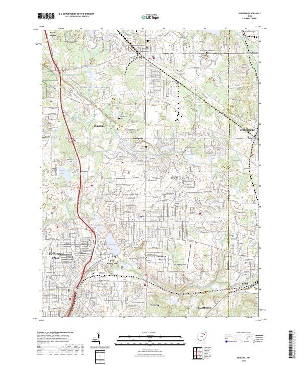
2023 Map of Hudson
USGS Topo · Published 2023About this map
The Cuyahoga Valley National Park borders the western edge of this suburban landscape, where the northern Summit County communities of Hudson, Stow, and Munroe Falls converge. The area is characterized by a dense network of residential subdivisions punctuated by numerous small lakes and ponds, including Silver Lake, Wyoga Lake, and Darrow Lake. Significant local history is preserved in sites like the Old Hudson Township Burying Ground Cem and the Draper Cem, reflecting the early settlement patterns of the Connecticut Western Reserve.
Find a feature on this map
53 named features on this map. Tap any name to fly to it.
Don’t see what you’re looking for? This feature index may not catch every label — zoom into the map to look around manually.
Map Details
Editions of this 2023 Hudson Map
This is the sole edition of this map. No revisions or reprints were ever made.
Other maps of this area

1903 · Cleveland
USGS Topo · 1:62,500

1903 · Akron
USGS Topo · 1:62,500

1905 · Akron
USGS Topo · 1:62,500

1906 · Kent
USGS Topo · 1:62,500

1906 · Chagrin Falls
USGS Topo · 1:62,500

1908 · Chagrin Falls
USGS Topo · 1:62,500

1950 · Cleveland
USGS Topo · 1:250,000

1953 · Aurora
USGS Topo · 1:24,000

1953 · Twinsburg
USGS Topo · 1:24,000
1953 · Northfield
USGS Topo · 1:24,000