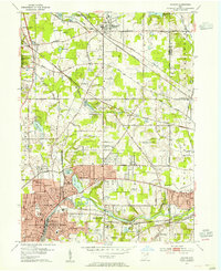
1953 Map of Hudson
USGS Topo · Published 1955About this map
The Cuyahoga River anchors the southern portion of this region, winding through Munroe Falls and the industrial northern edge of Cuyahoga Falls. This mid-century landscape is defined by its transition from the historic Connecticut Western Reserve roots to a suburban-industrial corridor. The area is a hub for several major rail lines, including the Pennsylvania RR and the Baltimore and Ohio RR, which intersect the growing residential centers of Hudson and Stow.
Find a feature on this map
70 named features on this map. Tap any name to fly to it.
Don’t see what you’re looking for? This feature index may not catch every label — zoom into the map to look around manually.
Map Details
Editions of this 1953 Hudson Map
This is the sole edition of this map. No revisions or reprints were ever made.
Other maps of this area
1903 · Cleveland
USGS Topo · 1:62,500

1903 · Akron
USGS Topo · 1:62,500

1905 · Akron
USGS Topo · 1:62,500
1906 · Kent
USGS Topo · 1:62,500
1906 · Chagrin Falls
USGS Topo · 1:62,500
1908 · Chagrin Falls
USGS Topo · 1:62,500

1950 · Cleveland
USGS Topo · 1:250,000
1953 · Aurora
USGS Topo · 1:24,000
1953 · Twinsburg
USGS Topo · 1:24,000
1953 · Northfield
USGS Topo · 1:24,000