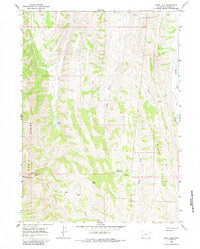
1967 Map of Huff Lake
USGS Topo · Published 1984About this map
The high ridges of the Sublette Range and Muddy Ridge dominate this portion of Lincoln County as it appeared in the late 1960s. The landscape is defined by its drainage systems, where Huff Creek and Little Muddy Creek flow through narrow valleys toward the larger Smiths Fork at the eastern edge of the quadrangle. High-altitude landmarks like Pine Knoll and the broad plateau of Collett Flat provide reference points for this high country.
Find a feature on this map
25 named features on this map. Tap any name to fly to it.
Don’t see what you’re looking for? This feature index may not catch every label — zoom into the map to look around manually.
Map Details
Editions of this 1967 Huff Lake Map
2 editions found
Other maps of this area

1909 · Montpelier
USGS Topo · 1:125,000

1911 · Montpelier
USGS Topo · 1:125,000

1936 · Cokeville
USGS Topo · 1:96,000

1942 · Cokeville
USGS Topo · 1:125,000

1955 · Preston
USGS Topo · 1:250,000

1958 · Preston
USGS Topo · 1:250,000

1962 · Preston
USGS Topo · 1:250,000

1967 · Big Park
USGS Topo · 1:24,000

1967 · Huff Lake
USGS Topo · 1:24,000

1967 · Porcupine Creek
USGS Topo · 1:24,000