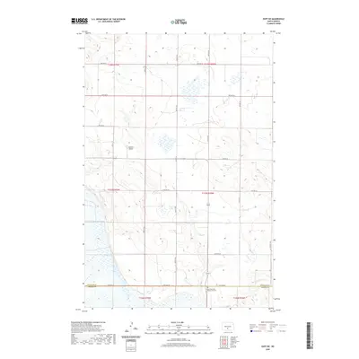
2020 Map of Huff NE
USGS Topo · Published 2020About this map
The rolling plains of south-central North Dakota are meticulously documented in this 2020 topographic survey, specifically at the boundary where Burleigh and Emmons Counties meet. This agricultural landscape is defined by a sparse network of section-line roads, such as 154th Ave SE and Moffitt Rd, which navigate the subtle relief of the Missouri Plateau. A primary anchor for local history is the Sloan Memorial Presbyterian Cem near the southern edge of the sheet, providing a genealogical point of interest for researchers of the region's early farming families. The terrain features numerous prairie potholes and seasonal drainages, including the headwaters of Glencoe Cr. Aviation history is represented by the privately-held Kalberer Airport positioned central to the map, while various other corridors like 141st Ave SE and 115th Ave SE crisscross the rural townships.
Find a feature on this map
18 named features on this map. Tap any name to fly to it.
Don’t see what you’re looking for? This feature index may not catch every label — zoom into the map to look around manually.
Map Details
Editions of this 2020 Huff NE Map
This is the sole edition of this map. No revisions or reprints were ever made.
Other maps of this area

1907 · Bismarck
USGS Topo · 1:125,000

1951 · Menoken SW
USGS Topo · 1:24,000

1951 · Menoken
USGS Topo · 1:62,500

1951 · McKenzie
USGS Topo · 1:62,500

1954 · Bismarck
USGS Topo · 1:250,000

1958 · Bismarck
USGS Topo · 1:250,000

1962 · Sugarloaf Butte
USGS Topo · 1:24,000

1962 · Menoken SW
USGS Topo · 1:24,000

1971 · Moffit SW
USGS Topo · 1:24,000

1971 · Huff
USGS Topo · 1:24,000