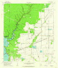
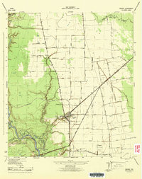
1960 Map of Huffman
USGS Topo · Published 1962About this map
Huffman serves as the primary hub in this corner of Northeast Harris County during the early 1960s, situated at the junction of the Missouri Pacific railroad and the historic Atascocita Road. The landscape is defined by the winding course of Luce Bayou and Cedar Bayou, which feed into the eastern expanse of Houston Lake. This survey illustrates a transitional period for the area, balancing established rural communities and early residential developments like Lakewood Heights and Hidden Echo.
Find a feature on this map
31 named features on this map. Tap any name to fly to it.
Don’t see what you’re looking for? This feature index may not catch every label — zoom into the map to look around manually.
Map Details
Editions of this 1960 Huffman Map
4 editions found
Other maps of this area

1916 · Crosby
USGS Topo · 1:24,000

1916 · Harmaston
USGS Topo · 1:24,000

1916 · Moonshine Hill
USGS Topo · 1:24,000

1916 · Huffman
USGS Topo · 1:24,000

1919 · Crosby
USGS Topo · 1:31,680

1920 · Harmaston
USGS Topo · 1:31,680

1920 · Moonshine Hill
USGS Topo · 1:31,680

1920 · Huffman
USGS Topo · 1:31,680

1943 · Liberty
USGS Topo · 1:125,000
1944 · Crosby
USGS Topo · 1:31,680