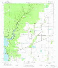
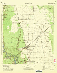
1960 Map of Huffman
USGS Topo · Published 1975About this map
The settlement of Huffman serves as the focal point of this 1960 survey, situated at the junction of the Missouri Pacific railroad and the historic Atascocita Road. This area along the western edge of the Harris Co Liberty Co line showcases a landscape transitioning from the bayou-dissected woodlands of the north to the more open fields and developing communities near Houston Lake. The intricate drainage network of Luce Bayou and its many tributaries, such as Mexican Gully and Shook Gully, highlights the topographic complexity that defined early navigation and land use in this part of East Texas. Along the shoreline, planned residential developments like Lakewood Heights and Hidden Echo represent the mid-century growth toward the waterfront, while established sites like the Huffman Sch and several local burying grounds, including the Huffman Community Cem and St Annes Cem, provide essential landmarks for genealogists and local historians.
Find a feature on this map
32 named features on this map. Tap any name to fly to it.
Don’t see what you’re looking for? This feature index may not catch every label — zoom into the map to look around manually.
Map Details
Editions of this 1960 Huffman Map
4 editions found
Other maps of this area

1916 · Crosby
USGS Topo · 1:24,000

1916 · Harmaston
USGS Topo · 1:24,000

1916 · Moonshine Hill
USGS Topo · 1:24,000

1916 · Huffman
USGS Topo · 1:24,000

1919 · Crosby
USGS Topo · 1:31,680

1920 · Harmaston
USGS Topo · 1:31,680

1920 · Moonshine Hill
USGS Topo · 1:31,680

1920 · Huffman
USGS Topo · 1:31,680

1943 · Liberty
USGS Topo · 1:125,000
1944 · Crosby
USGS Topo · 1:31,680