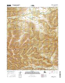
2016 Map of Hughes A-4 SE
USGS Topo · Published 2016About this map
Batza River winds through the southern reaches of this landscape, its path defining the topographic contours of the Yukon-Koyukuk region. In the northern sections, Baathbakdizuni Cr and Hughes Creek drain the upland terrain, illustrating the intricate drainage patterns essential to understanding the local hydrology. This 2016 survey highlights the relationship between the river valleys and the surrounding elevations across several townships, including t8n r20e and t7n r21e. The mapping provides a technical view of the remote interior, where the natural water systems remain the primary geographic landmarks in a region defined by its isolation and undisturbed drainage networks.
Find a feature on this map
7 named features on this map. Tap any name to fly to it.
Don’t see what you’re looking for? This feature index may not catch every label — zoom into the map to look around manually.
Map Details
Editions of this 2016 Hughes A-4 SE Map
This is the sole edition of this map. No revisions or reprints were ever made.
Other maps of this area

1951 · Hughes
USGS Topo · 1:250,000

1951 · Melozitna
USGS Topo · 1:250,000

1952 · Melozitna D-3
USGS Topo · 1:63,360

1954 · Melozitna D-4
USGS Topo · 1:63,360

1954 · Melozitna D-3
USGS Topo · 1:63,360

1955 · Hughes A-3
USGS Topo · 1:63,360

1956 · Hughes
USGS Topo · 1:250,000

1956 · Melozitna
USGS Topo · 1:250,000
1956 · Hughes A-3
USGS Topo · 1:63,360

1964 · Hughes
USGS Topo · 1:250,000