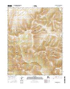
2016 Map of Hughes A-5 NE
USGS Topo · Published 2016About this map
Babantaltlin Hills dominate the central-western portion of this interior Alaskan landscape, providing a dramatic backdrop for the complex drainage patterns of the Koyukuk region. In the northeast corner, the Hogatza River cuts through the terrain, while the lower elevations are defined by the winding paths of Babantaltlin Cr and McLanes Cr. The map reveals a land structured by the Public Land Survey System, with township boundaries such as t10n r17e and t9n r18e marking the vast, unsettled reaches. The lack of road infrastructure or permanent settlements underscores the isolation of this Yukon-Koyukuk territory, where the topography itself remains the primary navigational guide for those traversing the river valleys and high ridges.
Find a feature on this map
10 named features on this map. Tap any name to fly to it.
Don’t see what you’re looking for? This feature index may not catch every label — zoom into the map to look around manually.
Map Details
Editions of this 2016 Hughes A-5 NE Map
This is the sole edition of this map. No revisions or reprints were ever made.
Other maps of this area

1951 · Hughes
USGS Topo · 1:250,000

1956 · Hughes
USGS Topo · 1:250,000

1964 · Hughes
USGS Topo · 1:250,000

1965 · Hughes
USGS Topo · 1:250,000
1986 · Hughes B-4
USGS Topo · 1:63,360
1986 · Hughes B-5
USGS Topo · 1:63,360
1986 · Hughes A-5
USGS Topo · 1:63,360
1986 · Hughes A-4
USGS Topo · 1:63,360
2016 · Hughes A-5 NW
USGS Topo · 1:25,000
2016 · Hughes B-5 SW
USGS Topo · 1:25,000