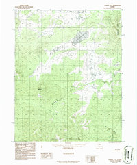
1986 Map of Hughes A-4
USGS Topo · Published 1986About this map
The Isahultila Mountains anchor the southern boundary of this interior Alaskan landscape, a region defined by complex drainage systems and significant elevation changes. Centrally located, Lake Tokhaklanten sits within a broad basin, fed and drained by unnamed tributaries that eventually contribute to the Batza River in the southeast. The terrain rises sharply toward the west at Bakatigikh Mountain, while the northeast is dominated by the Hokotena Hills.
Find a feature on this map
10 named features on this map. Tap any name to fly to it.
Don’t see what you’re looking for? This feature index may not catch every label — zoom into the map to look around manually.
Map Details
Editions of this 1986 Hughes A-4 Map
This is the sole edition of this map. No revisions or reprints were ever made.
Other maps of this area

1951 · Hughes
USGS Topo · 1:250,000

1951 · Melozitna
USGS Topo · 1:250,000

1952 · Melozitna D-3
USGS Topo · 1:63,360

1954 · Melozitna D-5
USGS Topo · 1:63,360

1954 · Melozitna D-4
USGS Topo · 1:63,360

1954 · Melozitna D-3
USGS Topo · 1:63,360

1955 · Hughes A-3
USGS Topo · 1:63,360

1956 · Hughes
USGS Topo · 1:250,000

1956 · Melozitna
USGS Topo · 1:250,000
1956 · Hughes A-3
USGS Topo · 1:63,360