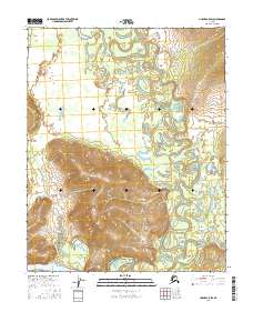
2016 Map of Hughes A-5 SW
USGS Topo · Published 2016About this map
The Koyukuk River and its major tributary, the Hogatza River, dominate this section of the Alaskan interior in the early 21st century. The map reveals an intricate network of oxbow lakes and meandering sloughs across the river valley, illustrating the constant shifting of these waterways over time. Rising above the wetlands and floodplains, Sixmile Pass serves as a distinct break in the local topography. This remote landscape, defined by seasonal water flow and drainage patterns like Hogatzakhotak Cr and McLanes Creek, remains largely untouched by permanent road infrastructure. The map records the complex hydrology of the Yukon-Koyukuk region, where the rivers serve as the primary geographical markers for navigation and land management.
Find a feature on this map
10 named features on this map. Tap any name to fly to it.
Don’t see what you’re looking for? This feature index may not catch every label — zoom into the map to look around manually.
Map Details
Editions of this 2016 Hughes A-5 SW Map
This is the sole edition of this map. No revisions or reprints were ever made.
Other maps of this area

1951 · Hughes
USGS Topo · 1:250,000

1951 · Melozitna
USGS Topo · 1:250,000

1954 · Melozitna D-5
USGS Topo · 1:63,360

1954 · Melozitna D-6
USGS Topo · 1:63,360

1956 · Hughes
USGS Topo · 1:250,000

1956 · Melozitna
USGS Topo · 1:250,000

1964 · Hughes
USGS Topo · 1:250,000

1965 · Hughes
USGS Topo · 1:250,000
1986 · Hughes A-6
USGS Topo · 1:63,360
1986 · Hughes A-5
USGS Topo · 1:63,360