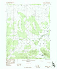
1986 Map of Hughes C-2
USGS Topo · Published 1986About this map
Siruk Creek meanders through this interior Alaska landscape, defining the drainage patterns of a region characterized by expansive wetlands and isolated water bodies. Published in 1986 from photography taken in the early 1970s, the map reveals a wilderness largely untouched by permanent road infrastructure. In the southeastern corner, Lake Mingkoket sits as a prominent landmark amidst the low-lying terrain. The survey captures a specific moment in the land management of the Yukon-Koyukuk region, reflecting the transition of territory defined by the Kateel River Meridian and township boundaries such as T 15 N and T 14 N. This cartographic record provides a clear view of the natural hydrology before any significant modern development altered the course of the local waterways.
Find a feature on this map
8 named features on this map. Tap any name to fly to it.
Don’t see what you’re looking for? This feature index may not catch every label — zoom into the map to look around manually.
Map Details
Editions of this 1986 Hughes C-2 Map
This is the sole edition of this map. No revisions or reprints were ever made.
Other maps of this area

1951 · Hughes
USGS Topo · 1:250,000

1956 · Hughes
USGS Topo · 1:250,000

1964 · Hughes
USGS Topo · 1:250,000

1965 · Hughes
USGS Topo · 1:250,000
1986 · Hughes B-1
USGS Topo · 1:63,360
1986 · Hughes D-1
USGS Topo · 1:63,360
1986 · Hughes C-3
USGS Topo · 1:63,360
1986 · Hughes B-2
USGS Topo · 1:63,360
1986 · Hughes D-3
USGS Topo · 1:63,360
1986 · Hughes B-3
USGS Topo · 1:63,360