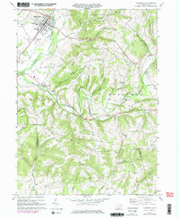
1968 Map of Hughesville
USGS Topo · Published 1978About this map
Hughesville serves as the primary hub of this 1960s landscape, with its residential grid bounded by Muncy Creek and Gregs Creek. The map documents the community's mid-century expansion, noting several trailer parks and the East Lycoming High Sch alongside the long-standing Fairgrounds. To the south and east, the terrain transitions into the steep ridges of Warn Hill and Broad Ridge, where smaller rural settlements like Moreland and Clarkstown are centered around local landmarks such as Moreland Community Ch.
Find a feature on this map
56 named features on this map. Tap any name to fly to it.
Don’t see what you’re looking for? This feature index may not catch every label — zoom into the map to look around manually.
Map Details
Editions of this 1968 Hughesville Map
Other maps of this area

1924 · Milton
USGS Topo · 1:62,500

1927 · Eagles Mere
USGS Topo · 1:48,000

1930 · Warrensville
USGS Topo · 1:62,500

1932 · Eagle Mere
USGS Topo · 1:62,500

1934 · Warrensville
USGS Topo · 1:62,500

1935 · Hughesville
USGS Topo · 1:62,500

1953 · Hughesville
USGS Topo · 1:62,500

1953 · Warrensville
USGS Topo · 1:62,500

1953 · Eagles Mere
USGS Topo · 1:62,500

1953 · Milton
USGS Topo · 1:62,500