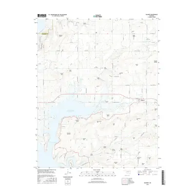
2016 Map of Hulbert
USGS Topo · Published 2016About this map
Fort Gibson Lake dominates the southwestern portion of this landscape, its indented shoreline reaching into the valleys of Fourteenmile Creek and Double Spring Creek. The town of Hulbert serves as a central hub, situated near the headwaters of the Fitzgerald-Soldier Cr Site 1 Reservoir. The surrounding terrain is defined by a dense network of named ridges and hollows, including the Fourteen Mile Hills, Ranger Hills, and Flint Ridge. Smaller settlements such as Eli, Lost City, and Shady Grove are scattered throughout the quadrangle, connected by rural routes like W Groat Rd and W Shady Grove Rd. For genealogists, the map identifies numerous local burial grounds, including Hulbert Cem, Keener Cem, Linder Cem, and the Lost City Cem, providing specific locations for ancestral research in this portion of Cherokee County.
Find a feature on this map
104 named features on this map. Tap any name to fly to it.
Don’t see what you’re looking for? This feature index may not catch every label — zoom into the map to look around manually.
Map Details
Editions of this 2016 Hulbert Map
This is the sole edition of this map. No revisions or reprints were ever made.
Other maps of this area

1896 · Pryor
USGS Topo · 1:125,000

1901 · Muscogee
USGS Topo · 1:125,000

1901 · Pryor
USGS Topo · 1:125,000

1905 · Muscogee
USGS Topo · 1:125,000

1946 · Fort Smith
USGS Topo · 1:250,000

1948 · Hulbert
USGS Topo · 1:62,500

1948 · Wagoner
USGS Topo · 1:62,500

1950 · Wagoner
USGS Topo · 1:62,500

1950 · Hulbert
USGS Topo · 1:62,500

1954 · Tulsa
USGS Topo · 1:250,000