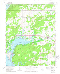
1974 Map of Hulbert
USGS Topo · Published 1978About this map
Fort Gibson Lake dominates the western landscape of this mid-1970s survey, illustrating the significant recreational and wildlife infrastructure established in Cherokee County. The map details the transition from the rugged Ranger Hills and Norwood Mountain to the organized public spaces of Sequoyah State Park. Local life centers on the town of Hulbert and smaller communities like Eli and Lost City, with numerous family and community landmarks such as Hinson Cem, Lower Ray Cem, and the Keener Ch providing essential points for genealogical research.
Find a feature on this map
55 named features on this map. Tap any name to fly to it.
Don’t see what you’re looking for? This feature index may not catch every label — zoom into the map to look around manually.
Map Details
Editions of this 1974 Hulbert Map
This is the sole edition of this map. No revisions or reprints were ever made.
Other maps of this area

1896 · Pryor
USGS Topo · 1:125,000

1901 · Muscogee
USGS Topo · 1:125,000

1901 · Pryor
USGS Topo · 1:125,000

1905 · Muscogee
USGS Topo · 1:125,000

1946 · Fort Smith
USGS Topo · 1:250,000

1948 · Hulbert
USGS Topo · 1:62,500

1948 · Wagoner
USGS Topo · 1:62,500

1950 · Wagoner
USGS Topo · 1:62,500

1950 · Hulbert
USGS Topo · 1:62,500

1954 · Tulsa
USGS Topo · 1:250,000