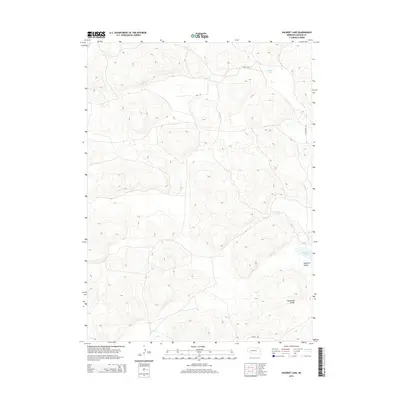
2014 Map of Hulbert Lake
USGS Topo · Published 2014About this map
Hulbert Lake and Haythorn Lake define the hydrology of this Sandhills landscape in Arthur County, where the topography is shaped by a complex network of depressions and rises. The terrain is characterized by named lowland basins including Haythorn Valley and Thoelecke Valley, which reflect the localized geographic naming conventions of Nebraska ranching country. Transportation is limited to a sparse grid of rural routes such as Kaps Rd, Sillhassen Rd, and Cerney Rd, which provide access to this isolated portion of the state. This USGS survey highlights the contrast between the seasonal or permanent water bodies and the surrounding arid valley systems, offering a clear view of the area's natural drainage and land use patterns.
Find a feature on this map
7 named features on this map. Tap any name to fly to it.
Don’t see what you’re looking for? This feature index may not catch every label — zoom into the map to look around manually.
Map Details
Editions of this 2014 Hulbert Lake Map
This is the sole edition of this map. No revisions or reprints were ever made.
Other maps of this area

1897 · Ogallala
USGS Topo · 1:125,000

1900 · Ogallala
USGS Topo · 1:125,000

1949 · Arthur
USGS Topo · 1:62,500

1950 · Velma
USGS Topo · 1:62,500

1950 · Arthur
USGS Topo · 1:62,500

1954 · North Platte
USGS Topo · 1:250,000

1956 · North Platte
USGS Topo · 1:250,000

1957 · North Platte
USGS Topo · 1:250,000

1967 · North Platte
USGS Topo · 1:250,000
1971 · Bear Hill
USGS Topo · 1:24,000