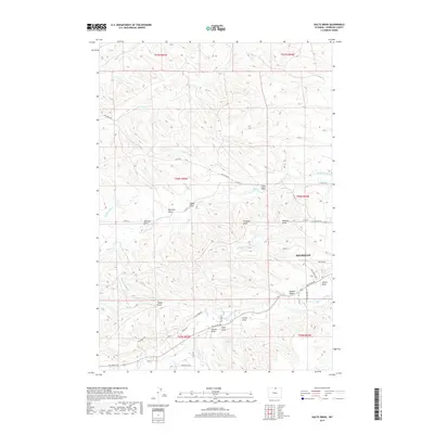
2017 Map of Hultz Draw
USGS Topo · Published 2017About this map
Sheridan's western residential expansion and the surrounding agricultural drainage systems are the primary focus of this modern survey. The landscape is defined by an intricate network of narrow valleys and water-management features, including the Alliance Ditch and the Alliance Lateral that divert water through the undulating terrain. A dense series of named draws, such as Hultz Draw, Gillispie Draw, and Hamma Draw, illustrate the complex topography that channels runoff toward Big Goose Creek and Soldier Cr. These topographical features often serve as the basis for property boundaries and local road placement, including Big Goose Rd and Keystone Rd. To the south, the Garrett Reservoir serves as a critical water management point, surrounded by family-named landmarks like Nelson Draw and Wolf Draw, providing a clear look at the intersection of municipal growth and traditional ranching geography.
Find a feature on this map
48 named features on this map. Tap any name to fly to it.
Don’t see what you’re looking for? This feature index may not catch every label — zoom into the map to look around manually.
Map Details
Editions of this 2017 Hultz Draw Map
This is the sole edition of this map. No revisions or reprints were ever made.
Other maps of this area

1895 · Dayton
USGS Topo · 1:125,000

1901 · Dayton
USGS Topo · 1:125,000

1909 · Sheridan
USGS Topo · 1:125,000

1911 · Sheridan
USGS Topo · 1:125,000

1955 · Sheridan
USGS Topo · 1:250,000

1958 · Sheridan
USGS Topo · 1:250,000

1962 · Sheridan
USGS Topo · 1:250,000

1964 · Wolf
USGS Topo · 1:24,000
1964 · Ranchester
USGS Topo · 1:24,000
1964 · Monarch
USGS Topo · 1:24,000