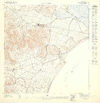
1947 Map of Humacao SE
USGS Topo · Published 1947About this map
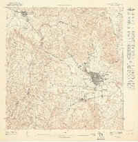
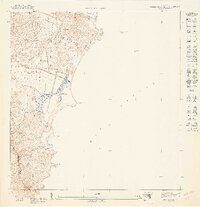
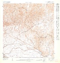
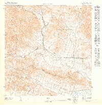
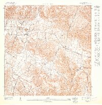
Agricultural colonias and industrial rail lines define this coastal landscape on the southeastern shore of Puerto Rico during the 1940s. The map illustrates a region transitioning between the sugar economy and maritime influence, where the Ferrocarril de Pasto Viejo and Ferrocarril del Este provided vital transport through the lowlands. Settlements like Pueblito de los Perros are situated near the prominent elevation of El Morillo, which overlooks the Mar Caribe. The network of watercourses, including the Río Humacao and Río Anton Ruiz, feeds into the marshy coastal plains near the border between the Municipio de Naguabo and Municipio de Humacao. This survey, prepared under the direction of Jorge J. Jiménez, captures the specific placement of agricultural outposts such as Colonia Mayo and Colonia Santa Teresa before mid-century modernization altered the local topography.
Find a feature on this map
14 named features on this map. Tap any name to fly to it.
Don’t see what you’re looking for? This feature index may not catch every label — zoom into the map to look around manually.
Map Details
Editions of this 1947 Humacao SE Map
This is the sole edition of this map. No revisions or reprints were ever made.
Other maps of this area
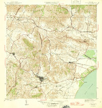
1946 · Humacao
USGS Topo · 1:30,000
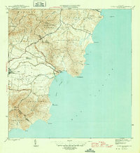
1946 · Punta Guayanes
USGS Topo · 1:30,000
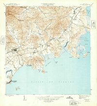
1946 · Naguabo
USGS Topo · 1:30,000
1947 · Humacao SO
USGS Topo · 1:10,000
1947 · Punta Guayanes NE
USGS Topo · 1:10,000
1947 · Punta Guayanes NO
USGS Topo · 1:10,000
1947 · Humacao NE
USGS Topo · 1:10,000
1947 · Humacao NO
USGS Topo · 1:10,000
1952 · Humacao
USGS Topo · 1:30,000

1952 · Punta Guayanes
USGS Topo · 1:30,000