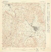
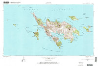
1947 Map of Humacao SO
USGS Topo · Published 1947This historical map portrays the area of Humacao SO in 1947, primarily covering Humacao Municipio as well as portions of Las Piedras Municipio. Featuring a scale of 1:10000, this map provides a highly detailed snapshot of the terrain, roads, buildings, counties, and historical landmarks in the Humacao SO region at the time. Published in 1947, it is the sole known edition of this map.
Map Details
Editions of this 1947 Humacao SO Map
This is the sole edition of this map. No revisions or reprints were ever made.
Historical Maps of Sector Gaspar F. Meléndez Through Time
7 maps found
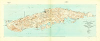
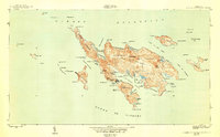
1943 Island Of Vieques
Humacao Municipio, PR
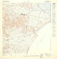
1947 Humacao SE
Humacao Municipio, PR
1947 Humacao SO
Humacao Municipio, PR
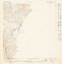
1947 Punta Guayanes NE
Humacao Municipio, PR
1948 Culebra And Adjacent Islands
Humacao Municipio, PR
1950 Culebra And Adjacent Islands
Humacao Municipio, PR
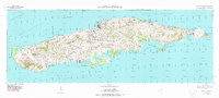
1951 Isla De Vieques
Humacao Municipio, PR
Featured Locations
- Sector Gaspar F. Meléndez, Las Piedras
- Sector Geño López, Las Piedras
- Las Piedras, Las Piedras
- Sector Los Tolentinos, Las Piedras
- Humacao, Humacao