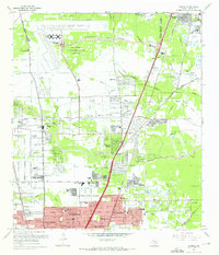
1967 Map of Humble
USGS Topo · Published 1967About this map
The Houston Intercontinental Airport dominates the northwest portion of this landscape, its expansive runways and Control Tower appearing in the late 1960s as a modern anchor for northern Harris County. This era of development is visible in the grid of suburban expansions like Greenwood Village and Parkwood Estates, which contrast with the older, more dispersed settlements of Humble and Dyersdale. The area is bisected by the Southern Pacific and Missouri Pacific railroads, traditional transit corridors that are increasingly joined by a network of regional roads such as North Belt Drive. Beneath this rapid growth, the older rural character of the land persists in the form of numerous small cemeteries like Koinm Cem and Morales Cem, alongside scattered Oil Wells and a large Oil Field to the southeast, marking the persistent role of the petroleum industry in shaping the local economy.
Find a feature on this map
71 named features on this map. Tap any name to fly to it.
Don’t see what you’re looking for? This feature index may not catch every label — zoom into the map to look around manually.
Map Details
Editions of this 1967 Humble Map
2 editions found
Other maps of this area

1915 · Houston Heights
USGS Topo · 1:24,000

1916 · Aldine
USGS Topo · 1:24,000

1916 · Settegast
USGS Topo · 1:24,000

1916 · Fauna
USGS Topo · 1:24,000

1916 · Harmaston
USGS Topo · 1:24,000

1916 · Moonshine Hill
USGS Topo · 1:24,000

1916 · Humble
USGS Topo · 1:24,000

1916 · Spring
USGS Topo · 1:24,000

1919 · Aldine
USGS Topo · 1:31,680

1919 · Humble
USGS Topo · 1:31,680