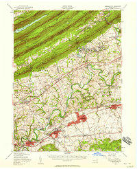
1956 Map of Hummelstown
USGS Topo · Published 1958About this map
The town of Hershey and its namesake chocolate-related landmarks anchor this mid-century survey, showcasing a landscape of industry, recreation, and education. The Milton Hershey Sch, Hershey Country Club, and the Hershey Park complex are clearly delineated, as is the Stadium and Hershey Hospital. The map reveals the intense transport corridor of the Reading Railroad and the Penn Highway, which connect Palmyra and Hummelstown across the fertile valleys of Swatara Creek.
Find a feature on this map
111 named features on this map. Tap any name to fly to it.
Don’t see what you’re looking for? This feature index may not catch every label — zoom into the map to look around manually.
Map Details
Editions of this 1956 Hummelstown Map
Other maps of this area

1891 · Lebanon
USGS Topo · 1:62,500

1892 · Lykens
USGS Topo · 1:62,500

1892 · Hummelstown
USGS Topo · 1:62,500

1892 · Harrisburg
USGS Topo · 1:62,500

1892 · Pine Grove
USGS Topo · 1:62,500

1893 · Lykens
USGS Topo · 1:62,500

1893 · Lebanon
USGS Topo · 1:62,500

1893 · Millersburg
USGS Topo · 1:62,500

1899 · Lebanon
USGS Topo · 1:62,500

1899 · Harrisburg
USGS Topo · 1:62,500
Featured Places
- Hershey, Derry Township
- Palmyra, PA
- Campbelltown, South Londonderry Township
- Rutherford, Swatara Township
- Annville, PA