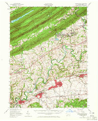
1956 Map of Hummelstown
USGS Topo · Published 1965About this map
Swatara Creek winds through the southern half of this landscape, anchoring a valley of productive farmland and growing industrial hubs. In the mid-1950s, the planned community of Hershey stands out with its Milton Hershey Sch, Milton Hershey Hospital, and stadium, illustrating the enduring influence of the chocolate industry on local geography. To the north, the sharp ridges of Blue Mountain and Second Mountain create a formidable natural barrier, carved only by dramatic water gaps like Indiantown Gap and Swatara Gap. Between these peaks lies the US Military Reservation Indiantown Gap, while the Appalachian Trail follows the high ground of Stony Mountain. The map detail is particularly useful for genealogy, showing numerous rural institutions such as Sattazahn Ch and Moonshine Cem that served the dispersed communities of East Hanover and North Annville.
Find a feature on this map
108 named features on this map. Tap any name to fly to it.
Don’t see what you’re looking for? This feature index may not catch every label — zoom into the map to look around manually.
Map Details
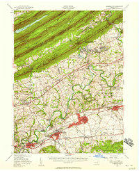
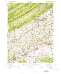
Editions of this 1956 Hummelstown Map
Other maps of this area

1891 · Lebanon
USGS Topo · 1:62,500

1892 · Lykens
USGS Topo · 1:62,500

1892 · Hummelstown
USGS Topo · 1:62,500

1892 · Harrisburg
USGS Topo · 1:62,500

1892 · Pine Grove
USGS Topo · 1:62,500

1893 · Lykens
USGS Topo · 1:62,500

1893 · Lebanon
USGS Topo · 1:62,500

1893 · Millersburg
USGS Topo · 1:62,500

1899 · Lebanon
USGS Topo · 1:62,500

1899 · Harrisburg
USGS Topo · 1:62,500
Featured Places
- Hershey, Derry Township
- Palmyra, PA
- Campbelltown, South Londonderry Township
- Rutherford, Swatara Township
- Annville, PA