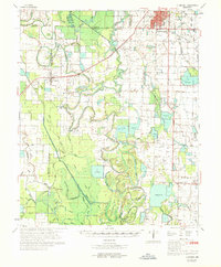
1969 Map of Humphrey
USGS Topo · Published 1969About this map
The agricultural hub of Stuttgart anchors the northeastern corner of this 1969 survey, where the Southwestern Railway and St Louis Southwestern Railway meet. This Delta landscape is defined by an intricate network of drainage and natural waterways, including the winding Bayou Meto and Wabbaseka Bayou. Between the larger settlements of Humphrey and Goldman, the map reveals a rural life centered on small communities and country parishes like Argo Chapel, Corinth Ch, and Jesus Name Ch.
Find a feature on this map
63 named features on this map. Tap any name to fly to it.
Don’t see what you’re looking for? This feature index may not catch every label — zoom into the map to look around manually.
Map Details
Editions of this 1969 Humphrey Map
This is the sole edition of this map. No revisions or reprints were ever made.
Other maps of this area

1935 · Altheimer
USGS Topo · 1:62,500

1935 · Varner
USGS Topo · 1:62,500

1935 · Noble Lake
USGS Topo · 1:62,500

1935 · Clarendon
USGS Topo · 1:62,500

1935 · Gillett
USGS Topo · 1:62,500

1937 · Stuttgart
USGS Topo · 1:62,500

1937 · England
USGS Topo · 1:48,000

1939 · Stuttgart
USGS Topo · 1:62,500

1941 · De Witt
USGS Topo · 1:62,500

1941 · Goldman
USGS Topo · 1:62,500