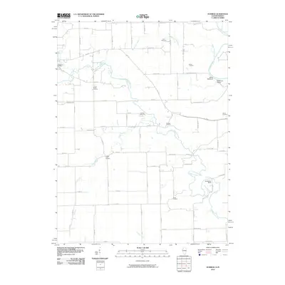
2010 Map of Humrick
USGS Topo · Published 2010About this map
The Little Vermilion River meanders across this rural borderland between Illinois and Indiana, where agricultural grid roads like 900 North Rd and State Line Rd intersect a landscape defined by sharp topographical features. Genealogists will find a cluster of significant burial sites including Elwood Church Cemetery, Yankee Point Cemetery, and Whitlock Cemetery. The river's path creates distinctive natural landmarks such as Horseshoe Bend and the steep elevation of Devils Backbone, which looms over Deadmans Hollow. This area, just north of where the Salt Fork joins the main waterway, remains a landscape of remote camps and quiet river bends. Local history is preserved in named landmarks like Brown Cemetery and the recreational grounds of Camp Assurance and Cherokee Hills Camp, providing a detailed look at the 21st-century rural character of these border townships.
Find a feature on this map
63 named features on this map. Tap any name to fly to it.
Don’t see what you’re looking for? This feature index may not catch every label — zoom into the map to look around manually.
Map Details
Editions of this 2010 Humrick Map
This is the sole edition of this map. No revisions or reprints were ever made.
Other maps of this area

1899 · Danville
USGS Topo · 1:62,500

1900 · Danville
USGS Topo · 1:62,500

1947 · Ridge Farm
USGS Topo · 1:62,500

1949 · Danville SW
USGS Topo · 1:24,000

1950 · Danville SW
USGS Topo · 1:24,000

1950 · Danville SE
USGS Topo · 1:24,000

1951 · Danville SE
USGS Topo · 1:24,000

1953 · Danville
USGS Topo · 1:250,000

1953 · Indianapolis
USGS Topo · 1:250,000

1955 · Danville
USGS Topo · 1:250,000